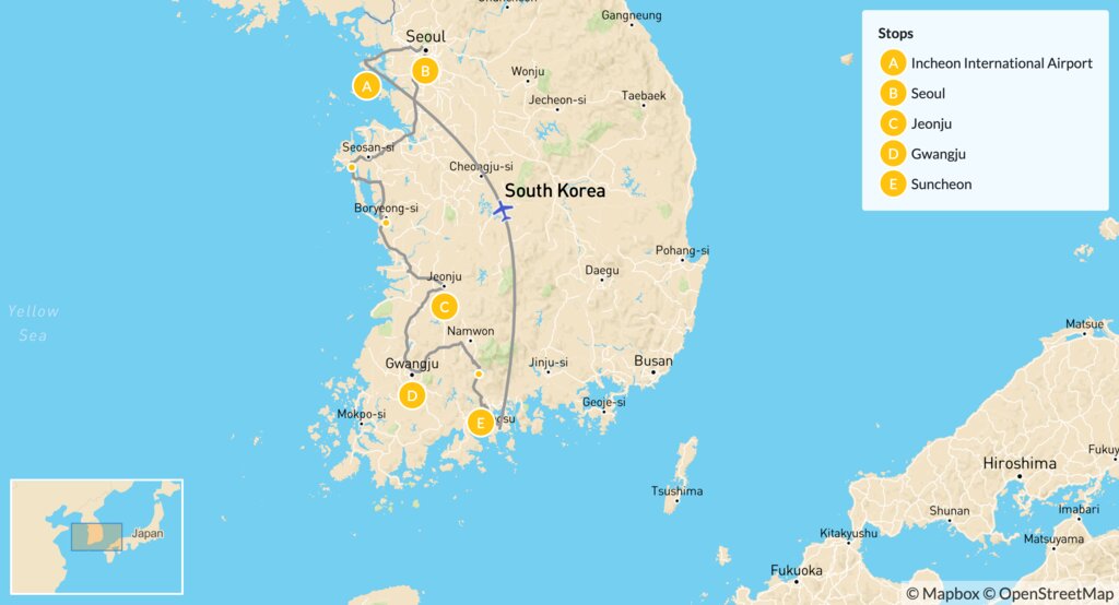
South Korea is a country filled with vibrant cities, each offering its own unique culture, history, and charm. Whether you’re planning a trip, studying geography, or just curious about the layout of the country, having a Korea city map is essential.
From the bustling streets of Seoul to the beaches of Busan, and the volcanic beauty of Jeju Island, a city map helps you navigate efficient transportation systems, locate top attractions, and plan your perfect Korean itinerary.
Major Cities Featured on a Korea City Map
Here are the key cities that you’ll find on any detailed map of South Korea:
Seoul (서울) – Capital City
- Located in the northwest
- Home to Gyeongbokgung Palace, N Seoul Tower, and top K-pop spots
- Known for technology, culture, and historic sites
- Connected via extensive subway lines
Busan (부산) – Coastal Metropolis
- Located in the southeast
- Korea’s second-largest city
- Famous for Haeundae Beach, Jagalchi Fish Market, and Gamcheon Culture Village
Incheon (인천) – Gateway to Korea
- Just west of Seoul
- Home to Incheon International Airport
- Features Chinatown and Songdo Smart City
Daegu (대구) – Fashion & Culture Hub
- Known for textiles, traditional markets, and cherry blossoms
- Great for off-the-beaten-path travelers
Gwangju (광주) – Historical Significance
- Located in the southwest
- Center of the 1980s democracy movement
- A rising food and art city
Daejeon (대전) – Science & Innovation City
- Central South Korea
- Hub of research institutes and innovation
Jeju City (제주시) – Island Capital
- Main city on Jeju Island
- Base for visiting Hallasan, beaches, waterfalls, and lava tubes
Types of Korea City Maps You Can Use
Interactive Digital Maps
- Use platforms like NAVER Map and KakaoMap (popular in Korea)
- Google Maps is limited in navigation but fine for general views
- Ideal for real-time transit updates, walking routes, and local spots
Printable Korea City Maps
- Perfect for offline access during travel
- Often available at tourist information centers and hotels
- Can include district breakdowns and transit lines
Tourist Maps
- Highlight attractions, shopping streets, historic sites, and food areas
- Provided free in airports, stations, or by tourism bureaus
Subway and Transit Maps
- Seoul, Busan, Daegu, and other cities have their own subway systems
- Maps show line transfers, station exits, and travel times
How to Read a Korea City Map
- City Districts: Most Korean cities are divided into “-gu” (districts) and “-dong” (neighborhoods)
- Road Labels: Highways and expressways are clearly marked for car or bus travel
- Landmarks: Look for icons representing palaces, parks, temples, and skyscrapers
- Orientation: North is usually at the top; maps are often bilingual (Korean/English)
Keywords: Korea city map, map of South Korea cities, South Korea tourist map, city maps of Korea in English
Travel Tips When Using a City Map in Korea
- Learn a few basic Korean phrases like “어디예요?” (Where is…?)
- Use apps like Papago for instant translation if signs are in Korean
- Subway systems are color-coded and extremely foreigner-friendly
- Save important locations (hotel, station, attractions) on your phone’s map app
- Look for QR codes on printed maps for AR or mobile directions
Recommended Korea City Map Resources
| Source | Type | Notes |
| NAVER Map | Digital | Best accuracy for Korea navigation |
| KakaoMap | Digital | User-friendly for real-time transit |
| Visit Korea Website | Printable PDFs | Free tourist city maps in English |
| Subway Korea App | Transit Map | Interactive metro planner |
| Korean Tourism Offices | Physical | Offer free maps, brochures & guides |
Conclusion
Having a reliable Korea city map is more than a convenience—it’s a gateway to smart travel, efficient navigation, and cultural exploration. Whether you’re planning your first Seoul trip or exploring Jeju’s natural beauty, a detailed city map can help you get the most out of every moment in South Korea.
Plan your route. Mark your must-visits. Explore with confidence.
FAQs
1. Where can I get a Korean city map in English?
Visit Korea tourism websites, use apps like KakaoMap, or pick up physical maps at airports, hotels, and visitor centers.
2. Is Google Maps accurate in South Korea?
Google Maps works for basic viewing but lacks real-time transit data. NAVER Map and KakaoMap are better for directions and public transport.
3. What’s the best map for walking around Seoul?
Use KakaoMap or print a tourist map that shows major districts like Gangnam, Hongdae, and Myeong-dong.
4. Do I need a city map if I use GPS?
Yes. A printed or offline map is helpful when Wi-Fi or mobile data is unavailable, especially in rural or mountain areas.
5. Can I download Korea city maps for offline use?
Yes. Apps like NAVER Map and Google Maps (limited) allow for offline saving in certain areas.
Also read: Things to Get at a Diner – Classic & Must-Try Dishes You Can’t Skip


Leave a Comment